|
|
Markham-Unionville Current Electoral District Map
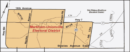
Description: The Markham-Unionville Electoral District is bordered by Steeles Avenue on the south and Highway 404 on the west. The northern boundary of the district is bordered by 16th Avenue east from Highway 404 to McCowan Road where the boundary travels south to Highway 7. The boundary then continues east along Highway 7 to Ninth Line and then south along Ninth Line to Steeles Avenue.
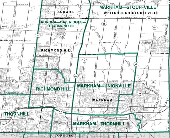
New Boundary Map
|
|